The ultimate users of the computer models developed by Dr. Isaac Ginis and his colleagues at URI and NOAA are the
National Weather Service, the Navy, weather researchers and staff at the National Hurricane Center, and the Joint
Typhoon Warning Center. They all use the output to produce official hurricane warnings and work closely with Dr.
Ginis to improve forecasting skills.
"The ultimate product of successful hurricane forecasting is successful public response." |
There is no question that Isaac's research has real world applications. Improved hurricane forecasting means more
lead time for the public as well as businesses to prepare. It also means reducing the areas under hurricane warning.
Typically today warnings cover a geographical area that is four times greater than meteorologically justified
because of uncertainties in forecasting ability. It is estimated that it costs states one million dollars per mile
of coastline for preparation and evacuation – even if the hurricane doesn't hit. "My research has a direct economic
effect," says Isaac. "By improving prediction in track and intensity we can reduce the warning area and save quite
a bit of money." More than 50% of the US population lives within 50 miles of the coastline. With the increase in
people living in coastal areas has come an increase in the importance of accurate forecasting. Isaac is at the
forefront of this effort.
|
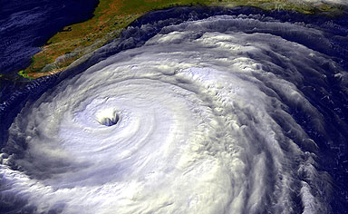
Hurricane Irene |
Isaac's research was put into stark practice during the last week of August 2011, as Hurricane Irene moved up the East coast.
Just as his work has shown, the ability to forecast Irene's track was far greater than the ability to forecast its intensity.
According to the NOAA website: Irene exemplifies the state of the science. With advances in satellite-based observations and
supercomputers, we have made tremendous strides over the past 20-30 years reducing track errors – average track errors now
are about half of what they were 15 years ago. However, we have made very little progress in forecasting the intensity and
structure changes of tropical cyclones during this period. Future progress will depend upon the success of programs such as
the Hurricane Forecast Improvement Project (HFIP), which is making use of advanced high-resolution models and enhanced
measurements of the hurricane core with Doppler radars to attempt to improve intensity forecasts. HFIP has already produced
some promising results that are just beginning to make their way into operations.
|
|
|
Research in operational forecasting entails utilizing observations from different sources to develop a better
understanding of hurricane physics, and then being able to use incoming data to create initial conditions and make
a forecast. The challenge for Isaac and his colleagues now is to improve the prediction of hurricane intensity. "We
are doing a pretty good job forecasting the hurricane track," says Isaac, "but we are not at good predicting how
strong the hurricane is going to be." There remain processes that are either poorly understood or cannot be resolved
through modeling with current levels of computational power. Track forecasting is governed by large scale atmospheric
winds, and thus easier to predict, whereas hurricane intensity is controlled by internal dynamics close to the
hurricane eye, plus complicated physical process in the atmosphere, the ocean and the air/sea interface.
Even with a perfect computer model, data are critical for the success of hurricane forecasting. Isaac is dependent
on data gathered from satellites as well as from sensing instruments deployed by reconnaissance planes, measuring
factors such as the depth of the warm water layer, which greatly influences hurricane intensity. One of the areas
Isaac has been focusing on for the last few years is to better understand the fluctuation of ocean temperature, not
only at surface but also at depth.
"What I am excited about is we can hope to make predictions on hurricanes maybe more than a week in advance," says
Isaac. "Presently we forecast five days in advance, but soon perhaps we can extend that to seven or more days. It's
very important for coastal communities and businesses to know well in advance where the hurricane is going to hit."