|
|
Melting Icebergs: Methods, Impacts, and Implications
10/22/2010
| Medea Steinman,
(Ocean Systems)
Tags: 10.20.10 webinar, icebergs, concept mapping
|
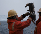 Dr. Ben Twining prepares a non-metallic Niskin bottle to collect trace metal samples. |
First and foremost, researchers and engineers depend on the powerful icebreaker that carries them to the Antarctic in the austral fall and brings them within shouting distance of the icebergs. From there, they are able to collect information about particles, nutrients and biota present in the surrounding meltwaters. Ben explained how the physics at the boundaries affect the movement of water and nutrients around an iceberg. These nutrients in turn have implications for phytoplankton and zooplankton living there.
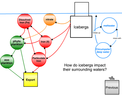 One of Ben's maps showing the physical, chemical and biological components of his research. |
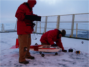 Unmanned aerial vehicle (UAV) used to take aerial images of and deploy GPS units at icebergs |
I highly recommend the video that shows the research team's use of a small remotely operated airplane (UAV)—the video is an asset attached to Ben’s concept map. The plane allows them to record overhead observations of iceberg structure and is used to drop GPS units onto the iceberg for tracking purposes. Watch the exciting conclusion when they attempt to land the plane back on the ship!
Following Ben’s talk, Annette deCharon shared some of her observations and experiences from her years of using concept mapping in a variety of contexts. Annette is the director of COSEE-Ocean Systems and a faculty member in the University of Maine’s School of Marine Sciences. She co-teaches a class for undergraduates at the Darling Marine Center and she described how she uses her “Luke Skywalker” exercise to help students get comfortable with concept mapping and as a way for them to share their own stories with each other about important influences in their lives, including people and experiences, that have led them to where they are now.
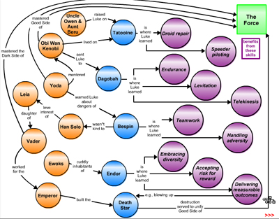 Annette's map of Luke Skywalker's life that she uses to help students share their life stories and focus on skills they've developed in their academic careers. |
She explained how the exercise has helped students articulate their skills and goals more clearly for prospective employers and advisors. Annette also shared a couple of fun exercises that help with two key sticking points in concept mapping: identifying key concepts and ideas, and effectively using linking phrases to clearly convey a map’s message. The exercises, called “Conceptionary” [download] and “At the Movies,” [download] are available in Annette’s concept map. Both hers and Ben’s maps will be available on this website early next week.
Want to keep a copy of the maps presented in this webinar?
- Download a pdf copy of the maps click here. (PDF, 373 KB)
- To view the interactive version of the maps in this webinar, click here.
When asked for a visitor's password, choose ROLEModel as the username and 2010 as the password.
- To share the map to your own profile, login to the Concept Map Builder with the username of ROLEModel and the password 2010.
Open the map and click "share" to send a copy of the map to yourself (if you have already registered for a COSEE profile.)
Need to register? Register now!
Have thoughts on this post? Send us a note and we'll share your ideas!
|

